Showing posts with label Cascade Pass. Show all posts

Monday, September 5, 2016

Pelton Basin


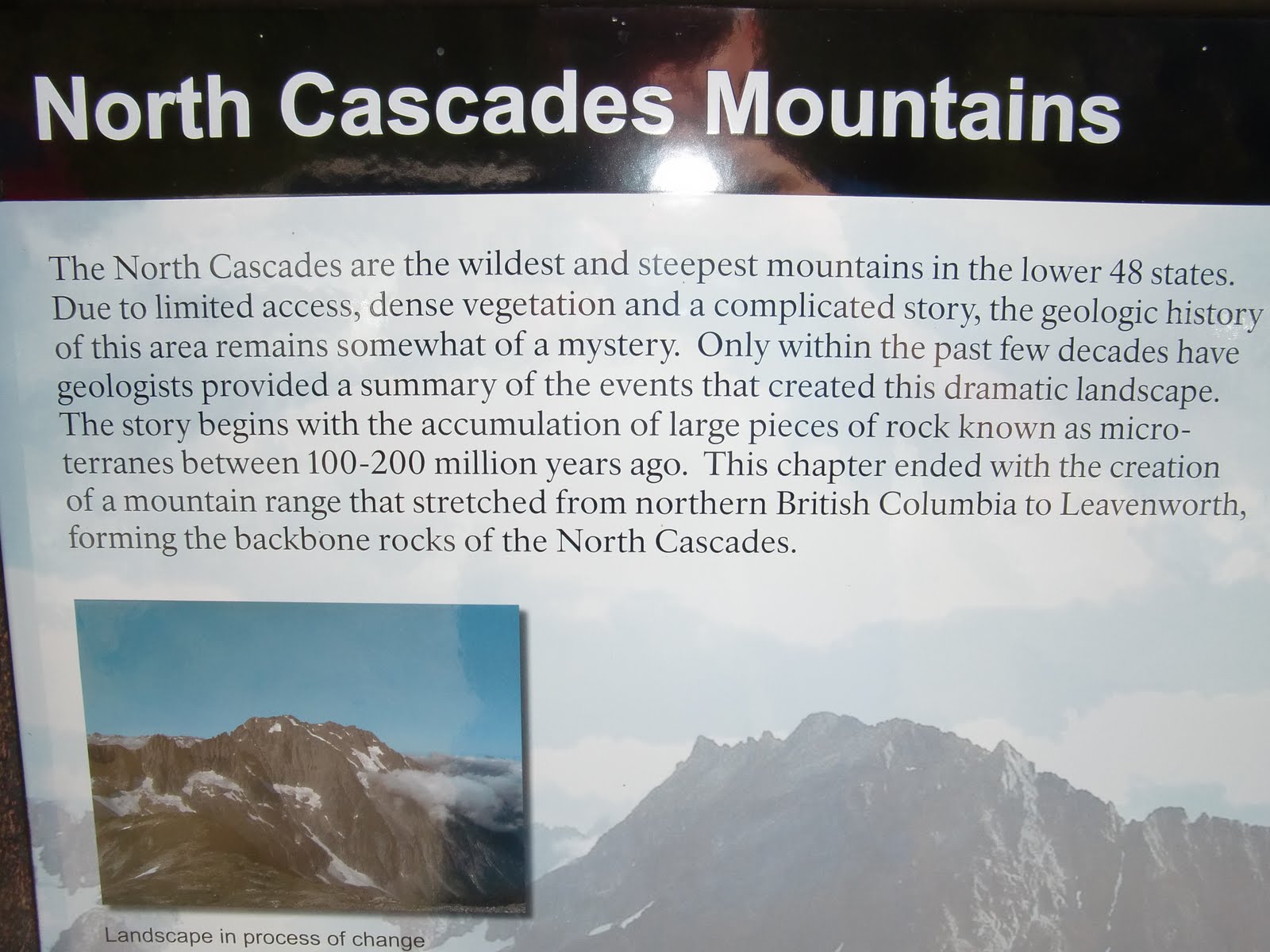
My friend Mike and I went up and over Cascade Pass last week, and hiked down into Pelton Basin.  I typically head up to the spectacular Sahale Arm, but I've heard good things about this trail, which goes all the ways to Stehekin. Cascade Pass trailhead is one of the most popular ones in the North Cascades National Park complex, and for good reason.

Pelton Basin is about a half mile beyond Cascade Pass. It rained the whole way in. I haven't hiked so long in the rain in a while. This isn't really a complaint--I have good memories of many rain hikes, and this one will be included in that group now. It's just something different. Glad I bought the right jacket, and if I had to do it again, I'd have an extra poncho to go over it, just in case things got cooler.

We made steady time up to the pass, which is still snow free. The hope was that on the other side of the pass, which I consider eastern Washington, things would dry up. Eventually they did, after we went past Pelton Basin campground. We probably went another half mile beyond the Basin, for something like 10 or 11 miles on the day, with some healthy climbing to the 6pass.

There were much better views of hanging glaciers in the valley just a bit further down the trail. Unfortunately, my camera battery died, so all I have here is a few pictures here, reflecting the conditions. Pelton Basin itself is basically a somewhat tight valley with some beautiful North Cascades style flat land in the middle, with a creek running through it. We looked for bears and other big, live animals, but at best we saw perhaps spots on far hillsides that may or may not have been.

In the next couple years, I want to take the trail to Stehekin. From the trailhead, it is a bout 31 miles or so, i think, but a bus into town can be caught from High Bridge, which is at about 22 miles. I could see it being done in a day with an early start, though there are many options.

So glad Mike could get out and hike this trail in the rain with me. Mike, you are the best! He had to get up early--probably in the 4 AM hour, just to meet me in Mount Vernon at 6 AM. We also had the pleasure of picking up two Swedish environmental science students who were on holiday at the trailhead, and were returning from Sahale Arm. It was kind of funny---they asked us for a ride to Marblemount, and hit the hitchhiking jackpot, with a ride all the way to Seattle.


Sunday, September 12, 2010

Return To Sahale Arm


Mike and I went up to Sahale Arm in the North Cascades on Saturday, taking our chances with the weather. We started early, beating any crowd, and had Sahale Camp to ourselves. This was really no big deal at first, considering the whole hike up to the 7600 foot camp was more or less in the clouds. We ran a little, but mainly it was a hike.

We happened across three deer bedded on the way up. Many marmots. According to Wikipedia, marmots hibernate roughly 7 to 8 months a year.

We hiked all the way up to Sahale Glacier, through fresh snow, with the visibility less than 20 feet. The fresh snow made the footing mildly sketchy, but it wasn't that bad.

The hike itself is steep, amounting to a 4000 foot climb from the car to the glacier, at probably about 800 feet of ascent per mile. It is steeper above Cascade Pass, on the way to Sahalee glacier, with essentially two climbs, with something of a plateau in between, above the remarkable Doubtful Lake.

We stood at the foot of the glacier for 15 or 20 minutes, waiting, in a cloud. There were hints of sun and blue sky in some directions, and so we hoped it would open up. Sure enough, slowly, the snow covered glacier began to reveal itself, and then Sahale Peak itself, against a cobalt blue sky. It was downright magical.

Views continued to improve over the next hour. Really special stuff, watching cloud patterns come and go through Cascade Pass, to reveal various peaks and glaciers in all directions. Pelton Mountain. Magic Mountain. Mount Johannesburg. Glacier Peak. The valley down to Chelan. 

In the picture above, there is a little mound in the foreground--that's one of the campsites for Sahale Peak--it is ringed in stones, to protect against the winds. Sahale Peak is this month's cover story hike for Washington Trails magazine, the WTA's periodical. Very worthwhile, though it would be really tough packing a full backpack. Last time up, three weeks ago, I ran into some folks who caught the full moon up there. They called it a once in a lifetime experience. Doesn't have to be, of course.

On the way down, the fall colors became more apparent--much moreso than three weeks ago--as huckleberries, heather and other flora are turning to reds and yellows. The colors will only get richer, presuming the weather holds and the snow doesn't come too fast.

We ran more on the down, but I kept stopping to take pictures. Mike, a much faster runner than me, is very patient, but as he said, he'd just finished Cascade a couple weeks ago, and so I don't think he minded too much. Amazingly to me, he had flown from the east coast the night before, with a 9 PM arrival.

For dessert, as it were, on the way down, we spotted three little specks above Doubtful Lake, perhaps a half mile away, as the crow flies. A mama bear and her growing cubs. We watched them ascend a rock wall that must've been a 5.9 climb.


Sunday, August 22, 2010

Sahale Arm


On Saturday, I went up Sahale Arm, off Cascade Pass in the North Cascades, for about 13 miles of trail. The day started with limited expectations. However, due to aesthetic conditions beyond my control, I ended up hiking, sitting, and even strolling more than running, spending the whole day in the mountains. It was an amazing day, with all sorts of wildlife out, and stunning views. 

The big news:  I saw FOUR BEARS! I never see bears, but on Saturday, they were hanging out separately, on steep slopes, just grazing like deer or elk. Three of them were specks, but one was near enough to get a much closer view, and I sat and watched him/her for fifteen minutes. Others reported seeing as many as seven, as well  as a lynx. I saw a few goats near the pass as well.

Hoary marmots and grouse were all over the place. I whistled at the marmots, and they would stand up and look around. A couple of them hung out on this cliff, just looking down towards Pelton Basin. We in my family call grouse "dummy chickens" and nothing I saw on Saturday made me change that tune. I chased one down a trail for at least a 100 yards. All it had to do was leave the trail, but it ran ahead of me on the trail, as if it were terrified. I even found a bear den, or what I think was one—the hole was big enough to cram a few bears in it. It kind of scared me.

My theory is the animals were all out because they need to make preparations for winter. I've heard about this sort of thing on the Discovery Channel.

The high point on the hike/run was 7600 feet, and there was some pretty steep climbing on the arm. I saw one other runner, and he was taking things much more seriously than me, motoring. The campsites at the Sahale Glaicer are rings of stones--there's one in the pic below of me in the foreground, before the sea of mountains. I want to camp there now--the folks I talked to who camped there the night before, under a full moon, called it an experience of a lifetime.

There were clouds in the sky, but everything was visible for ten miles, and that was enough, with Boston Basin, Mt. Johannesburg, Magic Mountain, the triplets and who knows what else viewable. Doubtful Lake is stunning, with an island sitting in the middle. The views to the east, down towards Park Creek and Chelan speak to the imagination. Maybe Labor Day weekend. I saw and even began the Ptarmigan Traverse trail, which is an epic mountaineering experience in the North Cascades.

More pics here.

It was a great day out on the trail, lost in thought, taking pictures, turning corners. I missed out on Waldo, and my congrats to all my friends who did it. It just didn’t sound like a good idea for me this year. Some year, hopefully. My fitness is down, and I can really feel my back when I try to seriously run. I did run steady down from the Pass, and the whole of the day wore me out. I plan on doing Baker Lake as my next 50k, and I’ll have a fun run on Cutthroat Pass in the North Cascades with my family next week, and then volunteer at Cascade Crest.


Sunday, August 15, 2010

Cascade Pass


I told a friend today that with the late arrival of summer, I’ve been almost manic in getting out. I keep telling myself to chill-I need to chill like chilli, be cool. I think I’m going to take a pass on Where’s Waldo, as my running is just not good enough, and I don’t want to drive 7 hours just to have a bad day. I will do the Cutthroat Classic, which I'm sure I can handle. But these are only events. The thing is to be happy, and not let events drive the bus. And quit registering so early.

So, at about 2 PM yesterday, in light of the amazing hot weather, I decided to bolt up to Cascade Pass.

The Cascade Pass trailhead sits at the end of the Cascade River Road, 23 miles east of Marblemount, in the North Cascades National Park. It is a very popular hike, probably the most traveled hike in the park. There are great views of hanging glaciers off Mount Johannesburg, and wildflowers in abundance if the time is right. Cascade Pass is an ancient trail, used by the Upper Skagit tribe, to travel to Eastern Washington. One of these days I am going to launch from here to Stehekin, on Lake Chelan. Could happen next month.

Almost everyone was coming down as I was going up. One of my guidebooks recommends going up after 3 PM, just for this reason. I’d like to say I was following directions, but really, I spent my morning waiting on the cable guy. Bundling now, saving a few dollars, allegedly. 

I didn’t go up to Sahalee Arm, which requires an extra couple miles each way, and some heavy climbing. I'm posting a picture of the distances, just to give any runner friends who come this way an idea or two. I sort of wish I did go up to Sahalee, but the trail to Cascade Pass was rocky, and the road to the trailhead was really winding. I didn’t feel like dealing with both in the dark. Next time, maybe.

I ran some, and hiked fast some. The distance wasn’t enough for me, but no big deal. The climb to Cascade Pass is actually pretty good for running ups, I'd say.

And now today, I got to run with my good friend Breean, over from Spokane! This is very cool for me, as Breean and I used to run every Saturday and do marathons, some years ago now. He and his family are wonderful, and I wish that we saw more of each other.

Breean and I made it our mission to run from Lake Samish to Larrabee Park, or “Samish to Sea,” as I called it. I know the way, through the Land of the Lost, though it's a bit tricky. We made it, although it wasn't any remarkable piece of running, and then we literally went down to the salt water and swam. And then there was more swimming at Lake Samish later, which was just plain awesome, albeit short because I had to get home. With the 90 degree heat we've had this weekend, swimming is the thing to do. It's August.