I hiked and jogged my way from
Easy Pass to Thunder Creek in the North Cascades National Park on Saturday. This was my fifth time completing this route, which is a personal favorite. This year I was inspired to take this on by friends Ras and Kathy, who made this part of the UltraPedestrian Wilderness Challenge. I actually first met Ras
when we took this on together some years back.
This is a point to point route, which requires something of a plan. Others who have been doing this have biked up Highway 20 to pick up their vehicle. I was fortunate enough to connect with John, Chris, and Arya, who also were taking on this challenge on Saturday. We met at 4:00 AM at Colonial Creek, even before the birds chirp, and took Chris's rig up to Easy Pass. Chris was the superstar on the day, deciding to take on the route from Colonial Creek to Easy Pass, which is mostly uphill. This choice meant that we didn't have to shuttle the cars back at the end of the day.
The route: basically, three miles up to the top of Easy Pass, approximately 6500 feet. Then, down into the Fisher Basin, through one of the most beautiful subalpine valleys you'll ever find, with views of glaciers in the distance. A wild place, where wolves and wolverines wander. Fisher Creek reminds me of high Yellowstone creeks. The trail then descends into old growth forest, paralleling the creek, mostly descending. At Junction, you bend up into the Thunder Creek valley, for about ten miles until the Colonial Creek campground. The full route is about 24 miles.
I don't move fast these days, due to various infirmities and lack of overall training. I knew I'd be ok, as long as I managed the heat, which reached the 90s by the end of the day. The fast trail runner can knock this out in five to eight hours, maybe quicker. The footing isn't always smooth, though long stretches, including most of the last ten miles, is soft and fast.
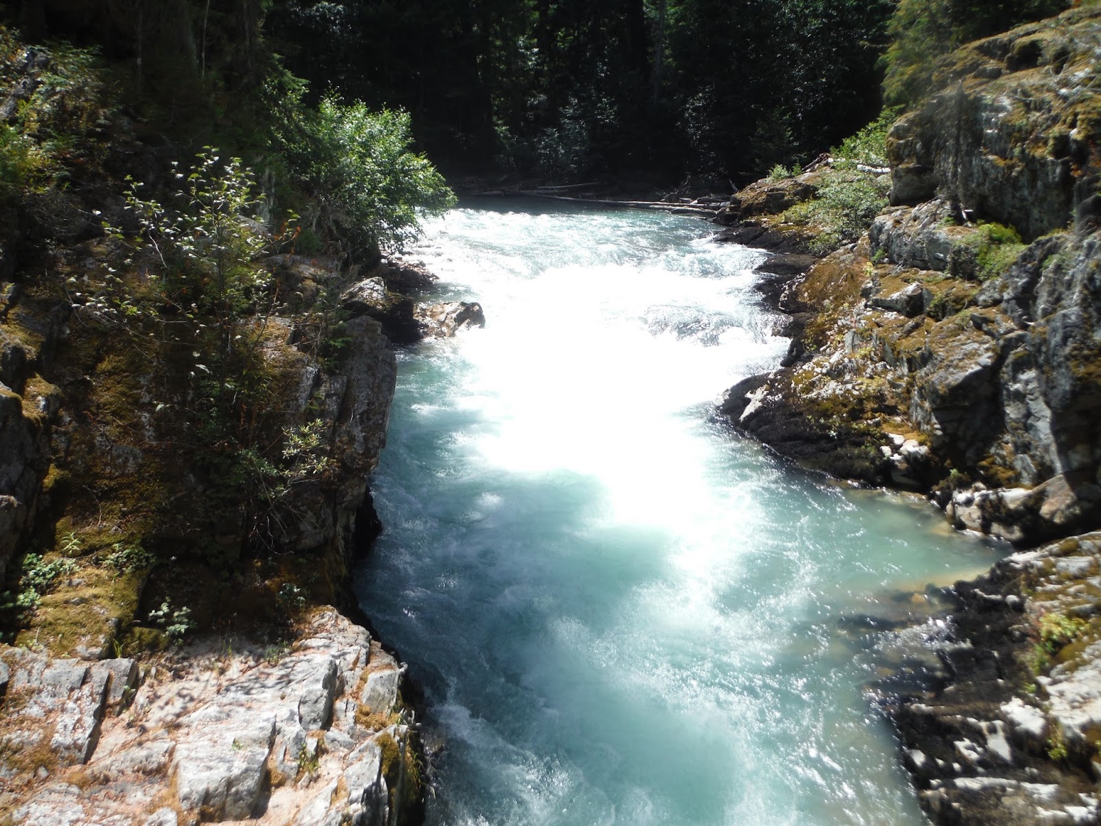
A quiet climb to Easy Pass, with the sun casting shadows on the peaks. I stopped to examine the wild blueberry bushes, the thistles, high alpine ferns. This trek is terrific for nature students, because it travels above treeline on an East facing Cascade slope, all the way down to a westside lower old growth valley. It is filled with mushrooms, golden larches, ancient cedars, and glacier fed creeks. The water of the creeks is milky, then jade green, and crystal clear. Having done this a few times, I would say
the best time is in September or October, when the larches are turning golden and the mushrooms are yellow, red, and purple.
I found a photo-friendly hoary marmot on the drop into Fisher Basin. This marmot seemed to be giving grouse a run for the money in the most likely to be caught with my bare hands category. Just hanging out, eventually Mr./Mrs. Marmot dropped into a hole, and then came out again after I hit a switchback.
The trail down into Fisher Basin has a bit of erosion, but is clear. The trail through Fisher Valley was occasionally bushy, but mostly is the delightful path through a field of grasses, berry bushes and fireweed. I ran into a few backpackers who were doing an eight day tour of the North Cascades, having started at Rainy Pass and looped all the way to Easy Pass. Two of them were wearing the same Montrail shoes I had on, which I thought was cool, since they had full-week packs.
There is plenty of water on the trail. Bugs are out right now. Stopping in some sections guaranteed a meeting with those biting fly types.
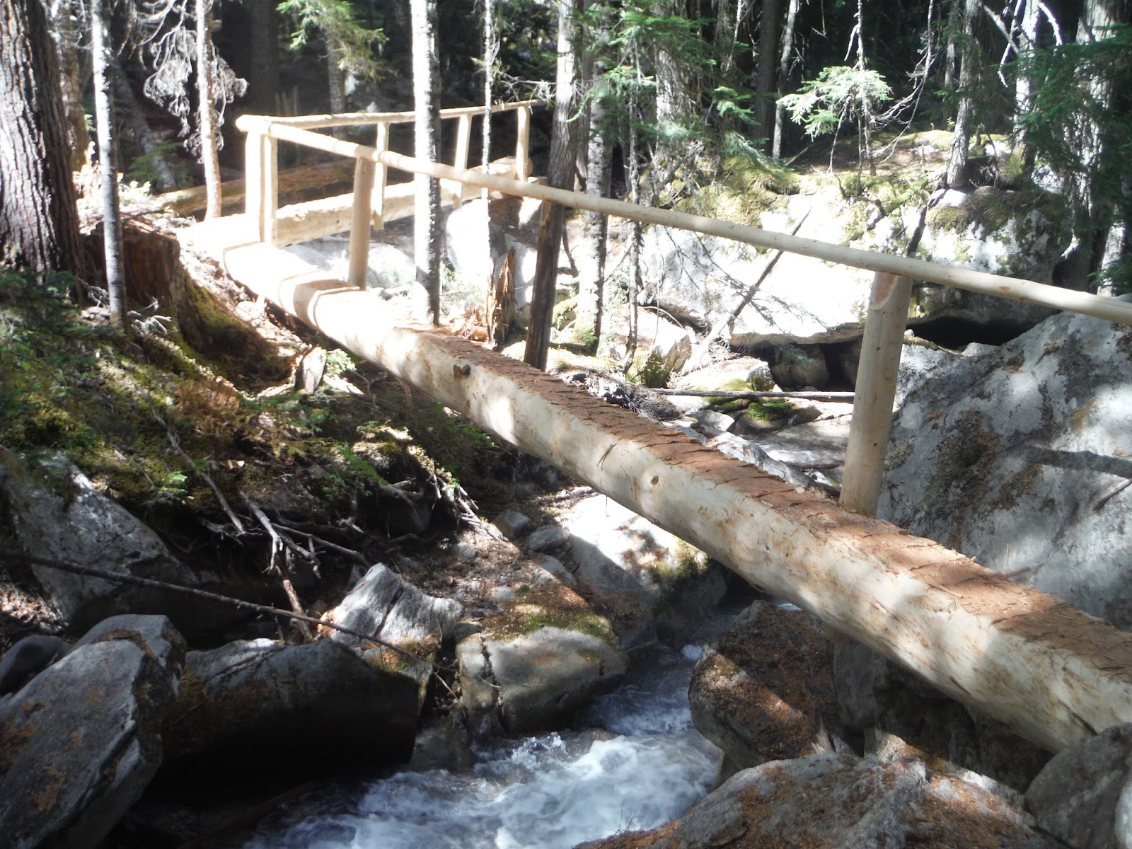
The sun was starting to cook, so dropping into the forest was good, after Fisher Basin. The trail here is rooty, but pleasant, with the occasional evidence of mudslide, and pullout spots along the creek. There are a number of log crossings here, but nothing unmanageable.
The Park Service is putting serious efforts into this trail this year. There are several new log bridge crossings, which are terrific. In the past, a couple of the creeks have posed a bit of a challenge to cross, and one high log crossing last year didn't have a rail. The engineering and care on these bridges is terrific, and its pretty cool to stand above the small waterfalls they span. The trail from Cosho down also has had some serious clearing--not nearly as bushy as in the past. I ran into a crew who were out there working. Kind of strange hearing a chainsaw running 15 miles away from the nearest road, but I'm glad for their work.
Lots of moss, as you descend. Lots of green, green moss.
I also ran into Chris as he made his way up to Easy Pass. We stopped and chatted for a few minutes. My hat is off to you Chris--quite the effort.
I was spent by the time I reached Junction. The sign at Junction says it is 9 miles to Diablo from there, but it sure feels like a long nine miles, and
the National Park Service site says it is 10 miles.
The Thunder Creek Basin trail is gorgeous, marked by big trees, the jade colored McCallister Creek, and occasional views of glaciers. I stopped at a couple creeks to cool off along the way, and soon enough I was strolling along the Thunder Creek trail, by ancient cedars, into Colonial Creek campground.
A spectacular day, with clear skies, warm to hot temps, clear trails, new friends, and plenty of adventure. Love the North Cascades.