Saturday, September 25, 2010

Mount Vernon Harvest Festival


I decided to stay home this weekend, having ran long in the North Cascades last weekend, and knowing I’ll be running Baker Lake next weekend. Home is Mount Vernon, Washington.

It seems like I’ve gotten so busy over the last year or two---I feel out of breath sometimes. There’s my running, but then there’s also my work, my volunteer stuff, the people I know, my house. Plus there's so many channels on television anymore, and I have a lot of spices and cookbooks in my kitchen, and I have so many books, and too many magazine subscriptions and Iphone apps, and I know I should just ebay half of the stuff around my house, if I knew how. I'm being facetious in writing this--I don't have kids, and so I can't be that busy, or so some friends tell me, and I suppose they're right, in a sense, but I do fill up my time, and an unplanned weekend at home feels so good sometimes. It seems like all my weekends in my 20s were unplanned.

So, on to the next paragraph.

I managed to get a bit of trail time on Chuckanut this morning, after sleeping in late. The wind was cutting over Chinscraper, lots of leaves dropping. It wasn’t much of a run for me, just a hike/climb to the top, and a jog down. Mainly, I conducted caveman skills tests, like throwing rocks and sticks at trees (which I imagined to be rabbits), and identifying edible mushrooms. If I had a coach, they wouldn’t be happy with my efforts this morning, but I did show real hunter and gatherer potential.

After Chuckanut, I headed back to Mount Vernon, my home's town, to check out the Farmer’s Market, and ended up enjoying the Fall Harvest Street Festival, the Friends of the Library booksale, and the John Deere tractor rally. I bought eight books for $4. I have a real book problem. Or maybe it's a book challenge. The tractors were cool. Nothing runs like a Deere, or so my friend Aaron tells me.

For the record, the Skagit Valley is going harvest crazy this weekend, with competing harvest festivals in Mount Vernon and Burlington, as well as the Oyster Run out in Anacortes on Sunday. On the way back from C-nut Mountain, I saw two or three roadside organic produce stands, and truck full of corn with a sign, 6 ears for $1. It’s a wonderful time of year here, at least when the sun is out. And it is.

Now I’m off to feed the birds, prune some trees, and maybe cut some wood. Just a really nice, forgettable fall day. (:


Sunday, September 19, 2010

Stehekin Run


Stehekin is a town on the north end of Lake Chelan, accessible only by boat, plane or trail. No roads in. It is known for its remote mountain bakery, the Stehekin Pastry Company, and as a place to truly get away from it all. I’ve always wanted to run there, and on Saturday I finally made it happen, with a 36 mile Pacific Crest Trail run.

I met my friend Craig at 4:40 AM in Burlington, and we drove up to the Bridge Creek trailhead together, where we met up with Heather, Brian and Catherine. Heather had originally suggested the run, and was a rockstar, managing to fit in an extra 14 miles for a cool 50 on the day. Brian and Catherine made a weekend of the run, coming out on Sunday after a night in Stehekin. Good plan.

As far as backcountry runs go, this one is pretty different. We had to make it 18 miles down the trail to the remote High Bridge campground by 12 noon, so that we could then catch the North Cascades shuttle bus down to the Bakery and the lake. After a few hours in the area, the plan was to catch the return shuttle back to High Bridge, and run it back out. So—basically, long trail run, a sweet intermission for pastries, and then another long trail run.

It was cold at the start of the day, mist and rain. The forecasts said showers, but in the North Cascades, you never know, as there are all sorts of microclimates and rainshadows. It turned out to be a great day, with increasingly improving weather as we approached Stehekin. I think it rained all day back home.

There are many trails into the town of Stehekin. We took the Pacific Crest Trail, which is a relatively easy route. Our path was broken into two segments: the Bridge Creek Trail, and the Old Wagon Trail. The Bridge Creek trail travels through subalpine forest and open slopes, and crosses the creek at a junction with the North Fork. Parts of this run seemed very backcountry.

After roughly 13 miles, the PCT trail converges with the Stehekin Valley trail, at Bridge Creek Camp. This section is called the Old Wagon Trail, and it is gorgeous in the fall, reminding me of the east coast this time of year, with its mix of deciduous and coniferous trees, changing colors. The trail continues to parallel Bridge Creek.

One of the coolest things about this run was seeing the recent burn from the Rainbow Bridge fire, which has shut down many trails on this side of the park this summer. I didn’t like seeing burnt old growth per se, but you could smell the fire, see the charred trees, and then you could also see the new bushes, ferns and other growth turning color with the fall. A striking dichotomy. I have a good friend who used to study fire ecology—it is really fascinating stuff.

We indeed made it to High Bridge by 11:15, and it was actually pretty easy. We slowed down quite a bit towards the end, talking with thru-hikers on the PCT, near their finish, and kicking around. The gorge at High Bridge is killer, with 100s of kokanees visible swimming in the water, and the river rocky and wild. The charming old shuttle bus arrived on time, and we drove down into the valley, first visiting the Stehekin Valley Ranch, and then the bakery, and then finally Lake Chelan and the Landing.

The Bakery may be the best aid station of all time, ever. After running 18 miles on mountain trail, in the mist, corn chowder and a gooey cinnamon roll were just the ticket. I ate way too much, throwing down a piece of pizza and a mountain bar on the way out, and suffered for it on the return. The Landing was a pleasant spot, where taking a nap seemed just right. We ran into more PCT thru-hikers, and I checked out the National Park Visitor Center.

Getting going again on the way back was tough, after roughly a 3 hour break. But we did, and soon we were motoring uphill, hiking when necessary, running when able. It did get tough towards the end—it just was a long day, but we stayed steady, and were back at the car by 7:45, and home for Saturday Night Live.

Some pics below, more pics here.


Sunday, September 12, 2010

Return To Sahale Arm


Mike and I went up to Sahale Arm in the North Cascades on Saturday, taking our chances with the weather. We started early, beating any crowd, and had Sahale Camp to ourselves. This was really no big deal at first, considering the whole hike up to the 7600 foot camp was more or less in the clouds. We ran a little, but mainly it was a hike.

We happened across three deer bedded on the way up. Many marmots. According to Wikipedia, marmots hibernate roughly 7 to 8 months a year.

We hiked all the way up to Sahale Glacier, through fresh snow, with the visibility less than 20 feet. The fresh snow made the footing mildly sketchy, but it wasn't that bad.

The hike itself is steep, amounting to a 4000 foot climb from the car to the glacier, at probably about 800 feet of ascent per mile. It is steeper above Cascade Pass, on the way to Sahalee glacier, with essentially two climbs, with something of a plateau in between, above the remarkable Doubtful Lake.

We stood at the foot of the glacier for 15 or 20 minutes, waiting, in a cloud. There were hints of sun and blue sky in some directions, and so we hoped it would open up. Sure enough, slowly, the snow covered glacier began to reveal itself, and then Sahale Peak itself, against a cobalt blue sky. It was downright magical.

Views continued to improve over the next hour. Really special stuff, watching cloud patterns come and go through Cascade Pass, to reveal various peaks and glaciers in all directions. Pelton Mountain. Magic Mountain. Mount Johannesburg. Glacier Peak. The valley down to Chelan. 

In the picture above, there is a little mound in the foreground--that's one of the campsites for Sahale Peak--it is ringed in stones, to protect against the winds. Sahale Peak is this month's cover story hike for Washington Trails magazine, the WTA's periodical. Very worthwhile, though it would be really tough packing a full backpack. Last time up, three weeks ago, I ran into some folks who caught the full moon up there. They called it a once in a lifetime experience. Doesn't have to be, of course.

On the way down, the fall colors became more apparent--much moreso than three weeks ago--as huckleberries, heather and other flora are turning to reds and yellows. The colors will only get richer, presuming the weather holds and the snow doesn't come too fast.

We ran more on the down, but I kept stopping to take pictures. Mike, a much faster runner than me, is very patient, but as he said, he'd just finished Cascade a couple weeks ago, and so I don't think he minded too much. Amazingly to me, he had flown from the east coast the night before, with a 9 PM arrival.

For dessert, as it were, on the way down, we spotted three little specks above Doubtful Lake, perhaps a half mile away, as the crow flies. A mama bear and her growing cubs. We watched them ascend a rock wall that must've been a 5.9 climb.


Sunday, September 5, 2010

Easy Pass to Colonial Creek


Jahson and I ran from Easy Pass to Colonial Creek in the North Cascades on Saturday. This is approximately 25 miles, maybe more, maybe less, with a steady climb for the first three miles, and then a gradual descent over the rest of the run. I did this in the deep fall last year with Linda and Dan—a different run, as on Saturday you could see that the colors are only just starting to change now.

The run should’ve been easy, but I sort of struggled. I think I had too much food in the stomach, maybe the wrong fit of shoes, and I definitely noticed my quads/hamstrings aren’t all there yet. It wasn’t that bad—I just want to get better.

The trail is spectacular. WTA says "it's easily one of the prettiest hikes in the North Cascades." My pics here.

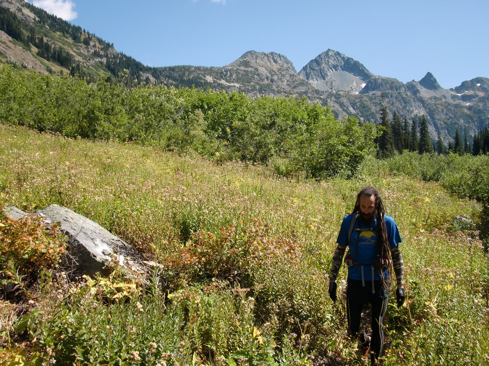
The Fischer Valley, which is reached after crossing Easy Pass, is remote, wild, and stunning. The valley forms from the headwaters of Fischer Creek, by Fischer Mountain. Glaciers hang in the distance. The brush along the trail is high; the valley walls jagged. I believe the last grizzly seen in the park was reported here. The empty meadows, like in the picture above, suggest to me a wilderness travelers might’ve come upon in the 1800s, when first coming west.

Though late in the year, we still managed to find plenty of huckleberries and thimbleberries. I did not see as many multi-colored mushrooms as on the last trip. The air is still in the Fischer Valley—you just want to slow down and look around. And so we did, for quite some time.

Finally, after an hour or so, we moved on--Jahson usually leading and me still dithering. At Junction Camp, about midway in, the trail turns down into the Thunder Creek valley. Big cedars become the norm, with white and aqua-blue creeks, like the MacCallister. The trail is soft, the footing easy. At some point, about 8 miles out, I decided to try running for an extended period. I was able to finish up at a somewhat steady clip, which is encouraging.

Teaser and the Firecat by Cat Stevens on the way home.

Tuesday, August 31, 2010

August Classics


This last weekend I ran the Cutthroat Classic on Saturday, and then bombed down to the Cascade Crest Classic 100 to volunteer/hang out on Saturday night and Sunday. I’m pretty exhausted, and it’s Tuesday. I won’t get much sympathy from those 100 milers, I know. Congrats to all who got out there.

While I did a lot this weekend, hanging with the family is always tops. Camping with Uncle Don and Paul is something I’ve been doing since I was 13, but not in recent years. Many great stories with these guys. We had one legendary trip to the Potholes in Eastern Washington, when Paul and I were teens, where we took no food, declaring to all that we were going to "live off the land."  We were 100% committed to the goal, for a whole week, and quite serious about it. I even remember stopping by Safeway on the way out, because we had to buy aluminum foil for all the fish we were going to bury in the coals of our fire to cook. And I think we picked up a lemon and an onion, for garnish. Things didn’t work out so well.

We met again, Friday night, at Pair-Again Lake outside Winthrop. Very tame, with kids and campfires, the sound of a movie playing on someone's computer. On Saturday morning, Paul’s wife Holley and I got up early, after I had one cooooold night, cowboy camped under the stars, and we caught the school bus to the race start. This was Holley’s third Cutthroat, I think, my fifth. We met my good friend Aaron M. at Rainy Pass, who announced that he’s expecting his next kid. Congrats!

Background:  Cutthroat is an 11.1 mile trail run.  The first five or so miles are on the Pacific Crest Trail, and amount to a beautiful climb up to Cutthroat Pass, first through subalpine forest, and then into the land of rock and ice, though the ice is gone this time of year. The race starts in four different waves, at Rainy Pass, on Highway 20. On the way up, there are gorgeous views looking back towards Maple Pass. Specatators cheer at the top--high point of 6800 feet--and it's a near screamer of a descent, with 6 miles or so of down, through dust and rock, to the finish. On the way down, there's one aid station where the gels and liquids are brought in by horses. It is an absolutely wonderful event, and it sells out every year. Thank you MVSTA and all your great volunteers!

Aaron crushed the course. I did not. I rolled my ankle once, and then again for good measure, and then, to top it off, in the last two miles I honored REM with an “I am superman, and I can do anything!” fall. Just bloods, no breaks. Look for it on failblog. As I said, it’s a dusty downhill—I love it. I was humming GnR’s Dust and Bones and Freefallin', in between falls.

My time was about 10 minutes slower than last time, but it could’ve been worse, and I took a lot of pictures. Clumsy feet, some decline in fitness, but not a complete disaster. The rolled ankle bothers me more than anything--the back was tolerable.

Afterwards, I had a freezing wash-me-up under the bridge (RHCP) in the Methow River, and then it was down south (Alabama) past Chelan to The Race. I dropped B’hamster Heather off at French Cabin, and in the process caught some great semi-Thorpe Mountain type views of Kachess and Rainier, fireweed in the foreground.

Later, I hung out at Hyak (53 m AS), and caught friends Mike and BJ coming through, both running strong. Lots of other great friends to hang out with through the evening, and I was constantly exercising my powers of observation. "So, you're working the aid station?"  "So, you're pacing?" "Hey, doing the race? Cool."

Sunday was Easton all the way, all the day. It never stops being amazing--watching people finish 100 miles, that is. It shouldn’t be. One hundred miles is a long long way, and anyone who can finish the distance is-- amazing. Mike came in way early. BJ finished strong. And I was particularly moved by Dave D.’s finish at the end of the day, with his whole family helping him limp in.

The pics here are of Cutthroat--I'll proably post of a few of Cascade, after a while.

Sunday, August 22, 2010

Sahale Arm


On Saturday, I went up Sahale Arm, off Cascade Pass in the North Cascades, for about 13 miles of trail. The day started with limited expectations. However, due to aesthetic conditions beyond my control, I ended up hiking, sitting, and even strolling more than running, spending the whole day in the mountains. It was an amazing day, with all sorts of wildlife out, and stunning views. 

The big news:  I saw FOUR BEARS! I never see bears, but on Saturday, they were hanging out separately, on steep slopes, just grazing like deer or elk. Three of them were specks, but one was near enough to get a much closer view, and I sat and watched him/her for fifteen minutes. Others reported seeing as many as seven, as well  as a lynx. I saw a few goats near the pass as well.

Hoary marmots and grouse were all over the place. I whistled at the marmots, and they would stand up and look around. A couple of them hung out on this cliff, just looking down towards Pelton Basin. We in my family call grouse "dummy chickens" and nothing I saw on Saturday made me change that tune. I chased one down a trail for at least a 100 yards. All it had to do was leave the trail, but it ran ahead of me on the trail, as if it were terrified. I even found a bear den, or what I think was one—the hole was big enough to cram a few bears in it. It kind of scared me.

My theory is the animals were all out because they need to make preparations for winter. I've heard about this sort of thing on the Discovery Channel.

The high point on the hike/run was 7600 feet, and there was some pretty steep climbing on the arm. I saw one other runner, and he was taking things much more seriously than me, motoring. The campsites at the Sahale Glaicer are rings of stones--there's one in the pic below of me in the foreground, before the sea of mountains. I want to camp there now--the folks I talked to who camped there the night before, under a full moon, called it an experience of a lifetime.

There were clouds in the sky, but everything was visible for ten miles, and that was enough, with Boston Basin, Mt. Johannesburg, Magic Mountain, the triplets and who knows what else viewable. Doubtful Lake is stunning, with an island sitting in the middle. The views to the east, down towards Park Creek and Chelan speak to the imagination. Maybe Labor Day weekend. I saw and even began the Ptarmigan Traverse trail, which is an epic mountaineering experience in the North Cascades.

More pics here.

It was a great day out on the trail, lost in thought, taking pictures, turning corners. I missed out on Waldo, and my congrats to all my friends who did it. It just didn’t sound like a good idea for me this year. Some year, hopefully. My fitness is down, and I can really feel my back when I try to seriously run. I did run steady down from the Pass, and the whole of the day wore me out. I plan on doing Baker Lake as my next 50k, and I’ll have a fun run on Cutthroat Pass in the North Cascades with my family next week, and then volunteer at Cascade Crest.