Showing posts with label North Cascades. Show all posts

Monday, September 14, 2020

Copper Ridge Lookout


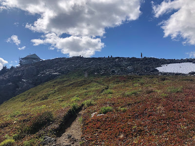
Craig and I did a long day trip to Copper Ridge Lookout about three weeks ago. The views were spectacular, as the skies were clear. This is one of the best spots for views in the North Cascades, and these photos don't do the 360 degree mountainscape justice.

We saw a mama bear with two cubs near the lookout, foraging. We also saw a goat right below the lookout. The marmot pictured here was very accomodating.

The hike was pretty dry--running water wasn't to be found after Boundary Camp, although there was a snow patch up high. We talked ot the lookout ranger--she was on an eight day stint, and I sort of envied her getaway. 

We didn't do the full loop, as I did a few years back with Mike and Rich, but I heard the sockeye were swimming the Chiliwack. The trail itself was in terrific condition, due to the work of trail crews. Very runanble, though we just hiked fast.

A great day, overall--certainly a highlight in a year lacking them. 

As I write this, the skies are now full of ash and soot, from horrible wildfires that have taken over the Washington, Oregon, and California. It's hard to fathom these remarkable views, just three weeks ago. The fires were really bad in 2018 as well, and have been increasing, presumably in relation to climate change. I know in my lifetime I've witnessed changes in the high country--this hike is a good example, as we expected more snow cover in August on the ridge, which in the past some times does not even open up. Also, the glaciers in Hannegan valley seem to have receded from when I first did that hike in the 1990s. 


Saturday, September 21, 2019

Lookout Mountain


I could have stayed home this morning, and coffee and the news would've been nice. Instead, I got up at 4:30, and drove up to Marblemount and the trailhead for Lookout Mountain. I've wanted to hike this trail for many years, and finally it is in the bag. I think this may have been the last weekend of summer, and the high country will probably be shutting down in a month or so. As Janis said, Get it while you can.

Lots of trucks on the road early this AM. I guess salmon fishing for kings and coho opened up on the Cascade River--and I saw a few on my way back. Also, hunting season is here.

This trail is a tough climb--about 4500 feet elevation gain, I think, over 4.5 miles. Mike and I did its sibling trail, Monogram Lake, a month or two ago. I think that was a tad harder, but we were carrying a bit more gear. The trail is fine, but there are some steep edges and so watch your step. Overall, the hike is about 9.5 miles.

I was the first one on trail, starting at daybreak (6:30 AM). It took me three hours to get to the lookout. I was walking through the clouds for a good portion of the way. The views up top were limited by the clouds, although I got a good look down valley at one point. The weatherman promised better.

A nice young couple from down south had the lookout to themselves last night. We talked and shared a bit, as I investigated what was to be seen. A lightning stool. An antique headlamp. A library with a definite nature writing focus. The log book (entry made). A stove, but I'm not sure if it worked. A couple beds. 360 views of the Baker, Shuksan, the Picketts, Hidden Peak, and so on, on a good day, with pictures on the wall to identify the mountains.

I was disappointed not to see any bears or other big animals. Maybe they saw me. I passed 13 or so people coming up, on my way down. Somebody's mom complained, "This is not a beginner hike." I think tomorrow I'll feel the downhill more than anything. My hips and quads are not fans. Age.

This was maybe my 10th lookout in Washington State. There's a nice new book out on fire lookouts in Washington--great write up in there on this hike. This also was my first solo hike in the high country in a little while--at least since last year, but I didn't hike much then. It felt good to get lost in my thoughts.

I got home in time for the second half of the UW Husky game, which we won, big, over BYU. Everyone's excited about Jacob Eason now.


Monday, July 22, 2019

Sourdough Mountain


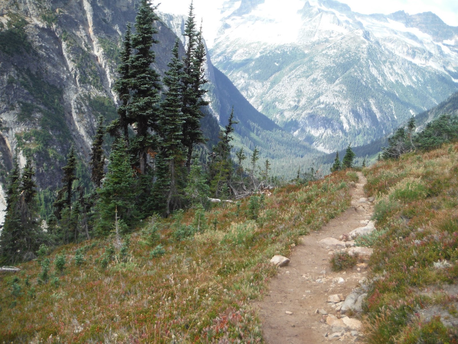
Craig and I went up and over Sourdough Mountain on Saturday. It is a personal favorite for each of us. Part of the North Cascades National Park. Hard—over 5000 feet of climbing in about 6 miles.  The first mile or two is really a grind.  But at about mile 3, you cross a mountain creek, the trees thin, and soon you’re on an open mountainside, with wildflowers all around, and crisp views of the aquamarine Diablo Lake, below. That's Diablo, above.

I like the workout. You know its going to be a huff. Everything feels earned, and then the payoff is worth the effort, especially on a clear day like we had.

On top, there are 360 degree views of the North Cascades---the Picketts, Hozomeen and Desolation, Jack Mountain, Colonial, and countless peaks I can’t name. Craig could. He writes guidebooks and outdoors articles, and is really knowledgeable in all things trail. Check out his 100 Classic Hikes of Washington, which includes Sourdough. A beautiful book, among many he has written. So, besides  chatting, he also pointed out a number of things I didn’t know. E.g. Pierce Mountain is not named after Franklin Pierce, but rather an early surveyor.  

360 degrees doesn't really capture it. That's just two dimensions, this so much more. Unobsructed views says it a bit better.

The day was perfect. HD skies for miles and miles. It seems the snowfields melted earlier this year—disturbing, with all the news of climate change. On the day, I saw a marmot, a couple toads and a turkey.

We went down the Pierce Mountain side.  I’ve done this once before. On a July in Saturday, we saw no one. No one. The Pierce Mountain campsite looked like a great place to spend a quiet night.

On the way down, we spied the Desolation Mountain Lookout, far up Ross Lake, sun reflecting off its roof. The Pierce Mountain trail is a bit rough and overgrown, especially through a burn section. It'd be tough after a recent rain. Most notable to me was the lack of water—dry times, all the way back to the car. The beauty of going down this side was the slower pitch through open field of heather, with long views. I expected to see a bear or two, but alas. Navigation wasn't an issue as cairns were well placed, but I had a bit more trouble once, when there was more snow. Once you reach the trees, the trail is readily identifiable, but before that, caution is warranted, as it wouldn't be too hard to drift away from the trail.

A whole loop can been done, but we opted to park a car at Ross Dam, and one at Diablo, saving us the final 5 or 6 miles. We still had a well-earned 15 miles for the day. My right foot wasn’t all that cooperative, rolling as it does once or twice on the way down. 

A magnificent day.


Monday, August 21, 2017

Easy Pass-Fisher Valley-Thunder Creek


My friend Craig and I finally were able to coordinate this last weekend and do the Easy Pass to Thunder Creek route. I consider this a classic North Cascades route, and this was my 6th time going point to point in one day. I'm out of shape, though always trying to improve, and this was a pretty big effort for me right now.  It's about 24 miles, with a 2000 foot climb up to 6500 feet at the start, over Easy Pass. The rest of the way is mostly downhill.

Craig was terrific to hike with. Craig writes guidebooks, and so he's really at home on the trails. It was great to share the trail, talking about this and that. He also took some terrific photos, as part of his annual Hike-A-Thon effort for Washington Trails Association. He's pretty near his goal of raising $5000 for trails. Hopefully we get out soon again.

So...this day will forever be remembered as that time I got chased by a bear. We were jogging slow through the Fisher Valley, with Fisher Creek maybe 50 yards to our right. Suddenly, I heard snorting, and crashing, and saw ears and a head coming my way. So many thoughts, compressed into a second or two. I yelled "Bear! Bear! Bear!" I ran forward. Craig said not to run. I probably was about to stop anyway--i'm not outrunning a bear. The bear came up on to the trail. I was turned towards it. I took picture #1. Then another, with a flash. The bear took off in the other direction. The theory is the bear was a two year old, still full of energy and curiosity. Happy not to get hugged, this time.

Pictures below. The Fisher Valley is one of the most beautiful places I know. It's also away from the day hikers. I love its remote feel. A good place for bears and moose and such. We did see moose pellets, and I got stung by a yellow jacket or something.

Bob Dylan and the Band on the way up. 6:30 AM meet up at Colonial Creek. 10.5 hours on trail. Home by 10, after going back to Easy Pass to pick up my car.


Monday, September 5, 2016

Pelton Basin


My friend Mike and I went up and over Cascade Pass last week, and hiked down into Pelton Basin.  I typically head up to the spectacular Sahale Arm, but I've heard good things about this trail, which goes all the ways to Stehekin. Cascade Pass trailhead is one of the most popular ones in the North Cascades National Park complex, and for good reason.

Pelton Basin is about a half mile beyond Cascade Pass. It rained the whole way in. I haven't hiked so long in the rain in a while. This isn't really a complaint--I have good memories of many rain hikes, and this one will be included in that group now. It's just something different. Glad I bought the right jacket, and if I had to do it again, I'd have an extra poncho to go over it, just in case things got cooler.

We made steady time up to the pass, which is still snow free. The hope was that on the other side of the pass, which I consider eastern Washington, things would dry up. Eventually they did, after we went past Pelton Basin campground. We probably went another half mile beyond the Basin, for something like 10 or 11 miles on the day, with some healthy climbing to the 6pass.

There were much better views of hanging glaciers in the valley just a bit further down the trail. Unfortunately, my camera battery died, so all I have here is a few pictures here, reflecting the conditions. Pelton Basin itself is basically a somewhat tight valley with some beautiful North Cascades style flat land in the middle, with a creek running through it. We looked for bears and other big, live animals, but at best we saw perhaps spots on far hillsides that may or may not have been.

In the next couple years, I want to take the trail to Stehekin. From the trailhead, it is a bout 31 miles or so, i think, but a bus into town can be caught from High Bridge, which is at about 22 miles. I could see it being done in a day with an early start, though there are many options.

So glad Mike could get out and hike this trail in the rain with me. Mike, you are the best! He had to get up early--probably in the 4 AM hour, just to meet me in Mount Vernon at 6 AM. We also had the pleasure of picking up two Swedish environmental science students who were on holiday at the trailhead, and were returning from Sahale Arm. It was kind of funny---they asked us for a ride to Marblemount, and hit the hitchhiking jackpot, with a ride all the way to Seattle.


Sunday, May 8, 2016

Sunflower Half Marathon


I returned to the beautiful Okanagan in Central Washington yesterday to run, shuffle, and walk the Sunflower Half Marathon. It was a gorgeous day, which after a while got really hot, reaching 87 degrees, without shade. 

The course is one of the better half marathons you'll find anywhere, at least when the flowers are in bloom. The Sunflower runs have been around for 35+ years, and include a relay and an "iron" or marathon distance. This was the first year for the half marathon distance, which is a point to point jaunt from the Chickadee trailhead to Twisp. I've ran the full marathon and the former 21 mile distance, and I think the half grabs the best section of the route. 

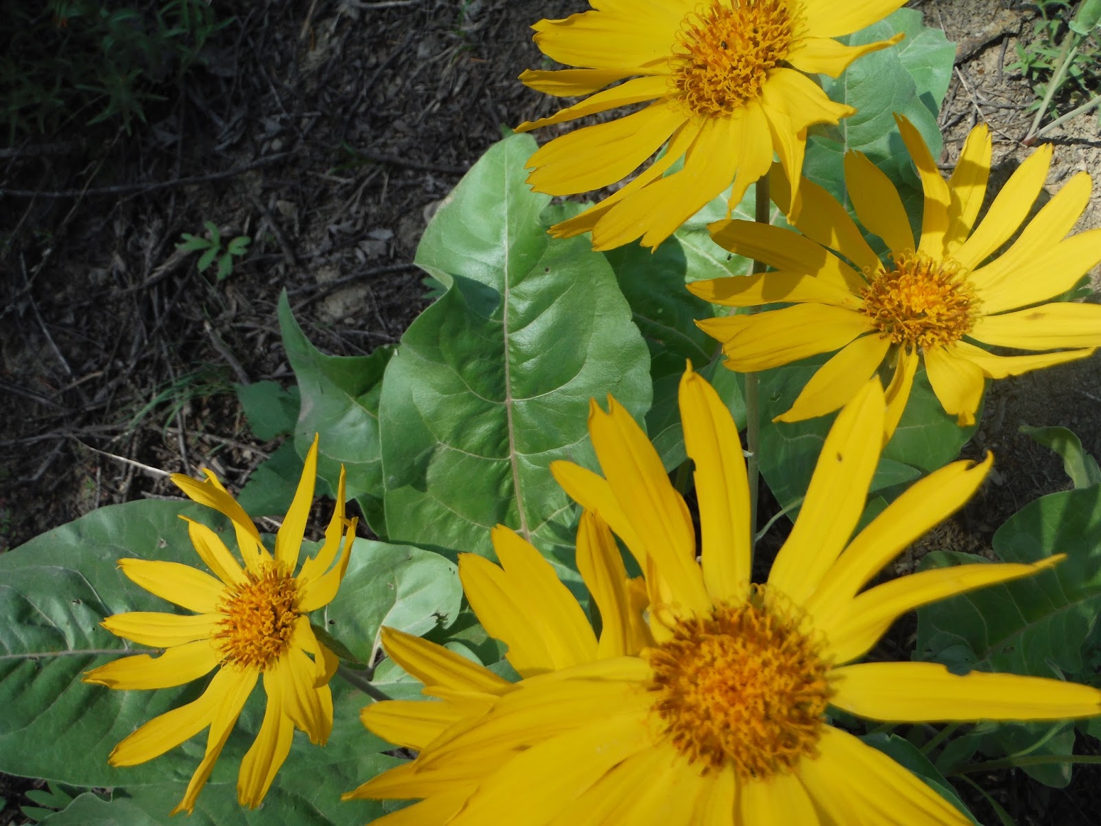
The trail is frequently lined with balsam root sunflowers and violet-blue lupine. Portions of the route are along a plateau, with views of the snow-covered North Cascades in the distance. Views of Patterson Lake and other lakes around the route. Rolling hills of the Okanagan, still green with spring. Sections of the course were burned in recent fires, and are just starting to experience new growth. The finish drops from the plateau back down to the Methow River and Twisp.

There are many runners, between the marathoners, the relay teams, and the half marathoners. The marathoners and half marathoners are bussed to the start, to enable the point-to-point. The altitude is a bit elevated, around 2000 feet. There are some climbs here and there, including a somewhat stiff one about mid-way through the half, after an exchange.

I drove over in the early AM, which isn't too tough from Mount Vernon. My effort was a struggle, as my left leg and shin didn't participate for the first few miles. Then it got hot, and I melt in the sun. I dunked my hat in streams at least three times, but have some bad sun burn today. Still, the distance was short enough that there was no real crisis--just slow times. I also took a bunch of photos.

Great to see friends over there from B'ham and the Okanagan. Great job by MVSTA, as always. The registration was gifted to me by a friend of a friend--thank you friends! Such a wonderful place to visit.

And then there's that North Cascades pass drive. Lots of people were out on the trailheads, with skis, snowshoes, and other gear.  I listened to the Seattle Springsteen concert on the way out and back, which we attended in March. It was an awesome show--Eddie Vedder even showed up. I purchased the cd, and it was pretty cool to hear the whole concert again on the drive. For me, the drive is all part of the journey to visiting the Methow, and so it's part of the memory, and so I mention it here.