Showing posts with label Mount Rainier. Show all posts

Saturday, May 27, 2017

Blanchard Mountain


Feeling really good. I got up early on the Saturday morning of a three day weekend and hiked and jogged around Blanchard Mountain. I threw in the British Army Trail, and looped back via the logging roads. Just an absolutely terrific morning on trail.

I have an old phone, and I'll replace it one of these days. It doesn't capture the best pics, but I'd rather throw these up here and have them then not. These pics are like rumors of the full view. The temps were in the 70s, not a cloud in the sky, and the trails were not too busy, because of the early start.

I've only taken the British Army Trail a couple times. It seems like t lot of work has been done on the trail in the last couple years, and the white scrapes suggest to me that it is part of the Pacific Northwest Trail. It's a less-traveled gem, and the logging roads back to the upper parking lot was a quiet, solitary experience--just how I like it.  On the logging roads, the view of Mount Baker was tres magnifique at one point. A "Well, hello there! Sweet view!" kind of moment.

Mount Rainier was out too. Sitting square in the middle of the view, from the Overlook, looking down across the Skagit Valley flats and Bow. I do this loop all the time, but don't typically see it. The white capped Olympics Range was also in full view, over Anacortes. All here, said the mountains.

The State Legislature is wrestling with whether or not to protect Blanchard Mountain from logging, and for recreational use. It's a ridiculous debate, but politics are that way sometimes, I guess. Frankly, it looks like a lot of logging has already occurred up there, selectively. The trail is quite a bit different from when I first started running and hiking up there, so many years ago.  Also, there is four to five times the foot traffic. The place is very much used and appreciated. Blanchard Mountain needs to be preserved as it is.

Off the mountain for now. Might go up again this weekend; the weather is good. Cueing up the barbq now, with some Bob Marley beats kicking. Might have to be a homebody, and garden, roof care, and all those sorts of things. Lively up yourself, says Bob.


Train rolling around the corner on the waterline


I promise--Mt. Rainier sits large in the middle of this photo, if you squint. Click to enlarge.


Bow, Chuckanut Drive and the Skagit Flats


Skagit Flats in the foreground, than March Point, and the Olympics Range beyond


Another shot of Bow/Chuckanut/Skagit Flats


Lilly Lake


Lizard Lake - fish were hopping


Here's a fail picture of Mt. Baker.  The lighting didn't work. But the view is special, from the logging roads retiring to the upper Blanchard parking lot.

Saturday, July 4, 2015

Chinook Pass Loop


I completed the Chinook Pass Loop, down by Mount Rainier National Park yesterday.  The route is approximately 32 miles, and starts and ends at Chinook Pass. You can go clockwise or counter-clockwise, though I'd recommend counter-clockwise, because the final 5 miles on the clockwise route are tough uphill miles.

The basic route begins from the Chinook Pass parking lot, where you want to head towards the pedestrian bridge, pictured below. The clockwise route launches off onto the Pacific Crest Trail through the William O. Douglas Wilderness. To make this a loop, you then turn off onto the Laughingwater Creek Trail, and then come back via the Eastside Trail.

I was inspired to do this by friends Kathy and Ras Jahson, as part of their UltraPedestrian Wilderness Challenge. Thank you! You two got me out there, testing my limits--as I really wasn't in shape for this--and now here I sit reflecting back fondly on the day. Thanks too to friend Seth for giving me pointers on the loop the day before, having already run it a week or two before. Good memories, all--thanks!

I like that this adventure was in the William O. Douglas Wilderness. William O. Douglas grew up in Yakima, attended Whitman, and later went on to serve on the U.S. Supreme Court for several decades in the middle 20th century. He also wrote about the outdoors, and was quite an interesting character. In one famous decision, he argued unsuccessfully that trees should have standing in court. I have heard him called "Gooseberry Douglas".

I drove down the night before, arriving at 11:30 PM, and napped in the car until about 3 AM. I took an hour-plus figuring out where the trailhead was, and then getting my stuff ready. I locked the car at 4:21 AM, with the full moon still riding the sky.  I wanted to start even earlier, because I knew it was going to be a 90 degree day, and I melt in the sun. A night hike on the PCT on a warm summer night sounded classic. I settled for a pre-dawn start, which was great.

The PCT section is in full wildflower bloom right now. The trail is lined with wild blue lupine and Indian paintbrush, and their are fields of these everywhere. It's world class beautiful. The trail is easy running, with views of various lakes and hillscapes.  Mount Rainier pops out magnificently in certain sections, and Mount Adams and Mount St. Helens were also clear in the distance. I had the whole PCT to myself--early morning solitude, I suppose.

The Laughingwater Creek section of the trail is delightful, if you're headed down. It's easy and fast running, with just roots to look out for.  There's probably a loss of 3000 feet on the way down. I didn't see a lot of the Laughingwater Creek, but the area is well-shaded, and includes several little lakes. I ran into Jon headed the counterclockwise direction, also pursuing the challenge. Well-met, we were both enjoying empty trails and world-class views.

The Eastside Trail portion begins at beautiful Silver Falls, and soon thereafter the Grove of the Patriarchs. I stopped at the Grove to check out the old growth cedars and Douglas firs. The Eastside Trail is quiet and does not seem well-traveled by tourists, except near the Grove. Crystal clear water runs atop well rounded river rock in Chinook Creek, which parallels the trail. I didn't see Chinook salmon in the creek, but they may be running now.

The 90 degree afternoon sun was tough for me. I wore long sleeves and a hat with flaps, and the Eastside Trail was shaded, but it still got through, sapping me each time I walked through an unshaded area. I'm not in the shape for a distance like this, too. So, I had to sit on and off, taking my time, and listening to my body. Some of the pitches on the last 3 mile section to Cayuse Pass are miner type trails, going straight up the slope. For a bit there, I was contemplating sleeping on the hill. Even after Cayuse, there's still more climbing to be done to get to Chinook Pass, though not quite as steep. Fair warning to those who choose clockwise.

It was a monumental struggle for me, but I finally made it, happily climbing that last stretch, and coming out to Tipsoo Lake, circled in lupine, with couples and families strolling, taking pictures.


Sunday, August 8, 2010

Mowich Loop


Rich, Linda and I ran and hiked the Mowich Loop section of the Wonderland Trail on Saturday, in Mount Rainier National Park. As per Rich's wrist technology, the loop was 21 miles with over 7500 feet of climbing. I didn't really run well, in part because of the back but as much because of the time off. It didn't matter--it was good to get out and do something spectacular, after a long week. This qualified. 

Up high, the heather, lupine and paintbrush literally lined the trail, red, blue and red, as if cheering you on. It was about as beautiful a display of wildflowers as I've ever seen. A Bonkers for Botany special.

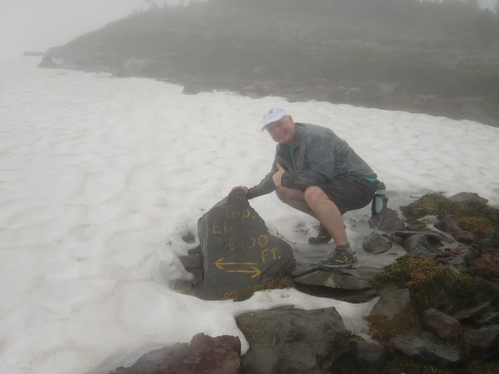
The weather was not particularly good, with rain through the afternoon, and there were no views of Mt. Rainier, but I didn't really notice, in the moment. Every turn on the trail provided something new and world class, and the company--Rich and Linda--was the best. Many many laughs. And then some.

We started the loop at the Mowich campground. This was Rich's program from the start--I was grateful to be along for the ride.  In the first hour or so, we climbed Tolmie Peak and checked out a lookout, where Forest Service workers were painting and making improvements. I sweated way more than I'd have liked going up, but just went with it.

Back to the Wonderland Trail loop--we descended Ipsut Pass, I think, by monster cliffs and through big tree country. Eventually we ended up down in the Carbon River area, which is a huge washout area--everything  is big in the Rainier area, sort of like Texas. Big rocks, big trees, big glaciers, big creeks. We checked out the Carbon glacier, which I failed to immediately recognize-duh-and then crossed a really long suspension bridge. Lots of friendly backpackers on trail, a few of whom asked, "Didn't we see you at Mowich this morning?"

A long slog up another pass, climbing through a few different ecological zones, including the river valley, up to the mountain streams and fields of flowers, and then to rock, lava, and ice. We ran into some goats in the mist, and they ran away too quick for any good photos. I took lots of photos, but the persistent rain and the camera operator inhibited me from really capturing things. But here's a link to an album I posted.

A long day was completed with nice descent from a pass, through wildflowers, and then a two mile jaunt by Eagle's Roost to Mowich. A really cool loop with the best of people. Just what the doctor ordered for me.


Sunday, August 1, 2010

Buck Creek


I worked the Buck Creek Aid Station on Saturday at the White River 50 miler. I cut watermelon into triangular slices and stacked them on plates. I put peanut butter and jelly on bread slices and cut them into bite size sandwiches. I also sliced Payday bars. It was a fun day!